Lang Son Overview
Lang Son Province is a province in far northern Vietnam, bordering Guangxi Province in China. Its capital is also called Lang Son, which is a strategically important town at the border with China and is 137 kilometers (85 mi) northeast of Hanoi connected by rail and road. Lang Son Province is bounded by China in the north, Cao Bang Province borders the northwest, Ha Bac Province on the south, Quang Ninh Province starting on the south and extending to the eastern border and Thai Nguyen province to the west. Lang Son has two international border gates including Dong Dang railway border gate and Huu Nghi Quan border gate, two national border gates such as Chi Ma (in Loc Binh District) and Binh Nghi (in Trang Dinh District). Being a border province, it is important for trade between the two countries. It is accessible by road and rail from Hanoi, the Vietnamese capital, and it is the northernmost point on National Road 1A.
Topography
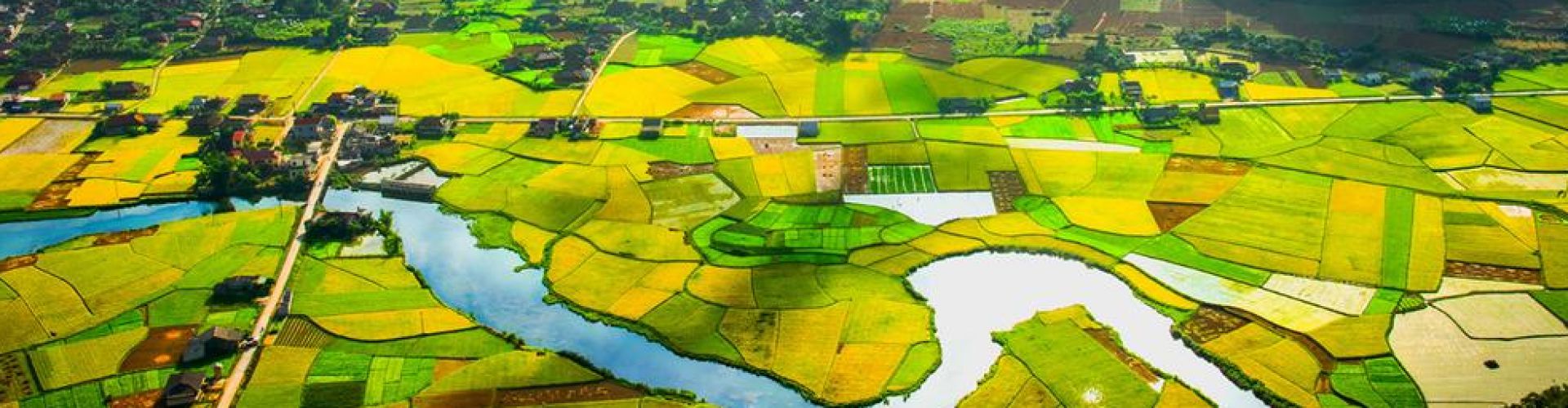
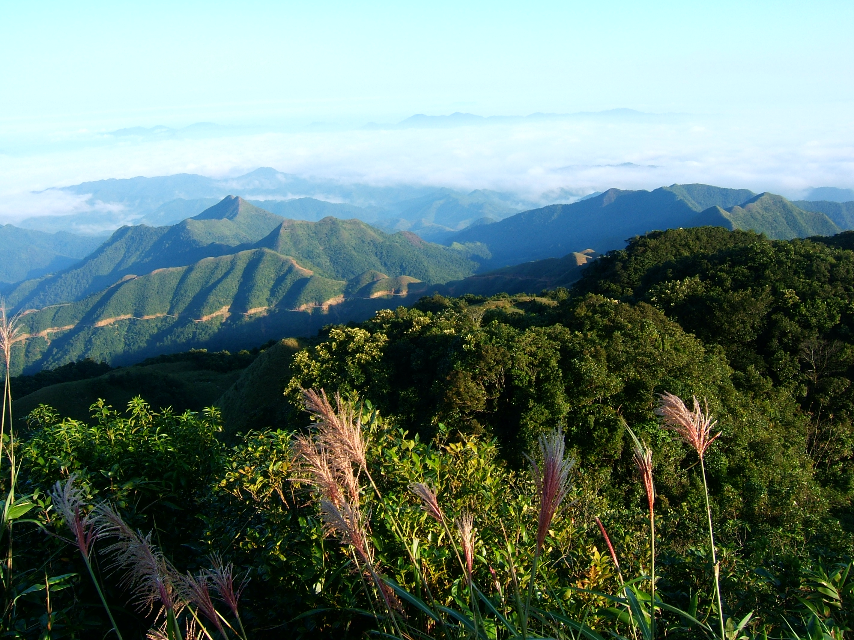
The province is set in karstic limestone mountains and valleys. Mountains and forests comprise 80% of the province’s area. The province measures approximately 123 kilometers from north to south and 126 kilometers from west to east. The average altitude of the province is 252 meters (827 ft) above sea level. The lowest point in the province is 20 meters (66 ft) towards the south of Huu Lung district and the highest point is at Mau Son Mountain, which is 1,541 meters (5,056 ft). Mau Son is to the east of the town of Lang Son by 30 kilometers (19 mi), and is surrounded by a series of small peaks, and snow falls on these peaks in winter. The Bac Son Mountains are located in the province and are calcareous in nature. Fertile valleys are framed by high mountain ridges, creating a scenic landscape. The complex network of rivers makes a good condition for agriculture. Main rivers that run through the province are: Ky Cung, Ba Thin, Bac Giang, Bac Khe, Thuong, Hoa, and Trung rivers.
Climate
The seasonal climate of Lang Son is similar to that of other provinces in northern Vietnam. In different seasons, the temperature is distributed pretty disproportionally because of the complex terrain. The average temperature in the summer is 28.5 °C (83.3 °F) and 12–13 °C (54–55 °F) in the winter.
Tourism
Lang Son has potentiality of mineral, forestry, tourism and trading. The province is proud of many culture and historical vestiges. They are Rampart of Mac Dynasty, Doan Citadel Vestige, Chi Lang Defile, Ky Cung and Bac Le temples. Apart of these, Ky Lua Market, To Thi and Mau Son mountains, Tam Thanh, and Nhi Thanh grottoes also attract many visitors every year. Especially, lots of people come to Ky Lua and Tam Thanh markets to shopping because the goods are abundant and cheap. Coming to there, tourists are interesting in Ky Lua or Long Tong traditional festivals. Ky Lua Festival takes place every year at Lang Son city (22nd to the 27th of the 1st lunar month). The festival honors Than Cong Tai who had merit to establish Ky Lua Street and broadening trade. The solemn palanquin procession imprints national tradition. There are many folk games. The festival attracts many people even Chinese visitors.
Transportation
Lang Son is 154km from Hanoi, 48km from Quang Ninh, 55km from Cao Bang, 73km from Bac Kan.


.png "Travel Tips")