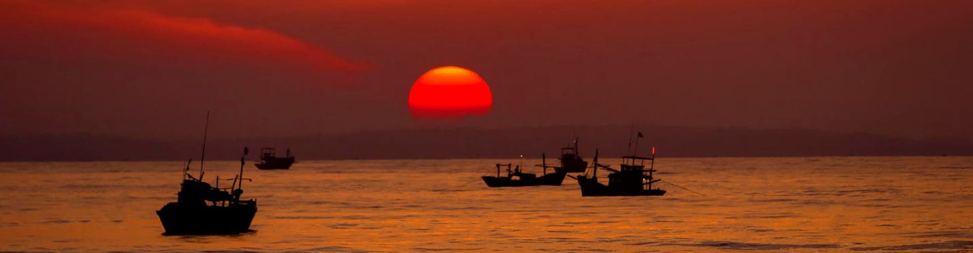
Myanmar General Information
is a country in Southeast Asia. Myanmar is bordered by Bangladesh and India to its northwest
China to its northeast, Laos and Thailand
Republic of the Union of Myanmar | |
| |
Capital | |
Largest city | Yangon |
Official languages | |
Burmese / Myanma | |
• Total | 676,578 km2 (261,228 sq mi) (39th) |
• Water (%) | 3.06 |
• 2017 census | 53,582,855 (2017) (26th) |
• Density | 76/km2 (196.8/sq mi) (125th) |
Currency | |
Time zone | |
right | |
Myanmar (English pronunciation below; Burmese: [mjəmà]) or Burma, officially the Republic of the Union of Myanmar, is a country in Southeast Asia. Myanmar is bordered by Bangladesh and India to its northwest, China to its northeast, Laos and Thailand to its east and southeast, and the Andaman Sea and the Bay of Bengal to its south and southwest. With a size of 676,578 square kilometres (261,228 square miles), Myanmar is the largest of the Mainland Southeast Asian states by area. As of 2017, the population is about 54 million. Its capital city is Naypyidaw, and its largest city is Yangon (Rangoon). Myanmar has been a member of the Association of Southeast Asian Nations (ASEAN) since 1997.
Myanmar is a member of the East Asia Summit, Non-Aligned Movement, ASEAN and BIMSTEC, but not a member of the Commonwealth of Nations. It is a country rich in jade and gems, oil, natural gas and other mineral resources. Myanmar is also endowed with renewable energy; it has the highest solar power potential compared to other countries of the Great Mekong Subregion. In 2013, its GDP (nominal) stood at US$56.7 billion and its GDP (PPP) at US$221.5 billion. The income gap in Myanmar is among the widest in the world, as a large proportion of the economy is controlled by supporters of the former military government. As of 2016, Myanmar ranks 145 out of 188 countries in human development, according to the Human Development Index.
Geography
Myanmar has a total area of 678,500 square kilometres (262,000 sq mi). It lies between latitudes 9° and 29°N, and longitudes 92° and 102°E. As of February 2011, Myanmar consisted of 14 states and regions, 67 districts, 330 townships, 64 sub-townships, 377 towns, 2,914 Wards, 14,220 village tracts and 68,290 villages.
Myanmar is bordered in the northwest by the Chittagong Division of Bangladesh and the Mizoram, Manipur, Nagaland and Arunachal Pradesh states of India. Its north and northeast border is with the Tibet Autonomous Region and Yunnan for a Sino-Myanmar border total of 2,185 km (1,358 mi). It is bounded by Laos and Thailand to the southeast. Myanmar has 1,930 km (1,200 mi) of contiguous coastline along the Bay of Bengal and Andaman Sea to the southwest and the south, which forms one quarter of its total perimeter.
In the north, the Hengduan Mountains form the border with China. Hkakabo Razi, located in Kachin State, at an elevation of 5,881 metres (19,295 ft), is the highest point in Myanmar. Many mountain ranges, such as the Rakhine Yoma, the Bago Yoma, the Shan Hills and the Tenasserim Hills exist within Myanmar, all of which run north-to-south from the Himalayas.
The mountain chains divide Myanmar's three river systems, which are the Irrawaddy, Salween (Thanlwin), and the Sittaung rivers. The Irrawaddy River, Myanmar's longest river, nearly 2,170 kilometres (1,348 mi) long, flows into the Gulf of Martaban. Fertile plains exist in the valleys between the mountain chains. The majority of Myanmar's population lives in the Irrawaddy valley, which is situated between the Rakhine Yoma and the Shan Plateau.
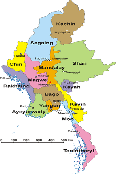
Map of Myanmar and its divisions, including Shan State, Kachin State, Rakhine State and Karen State.
Administrative divisions
Myanmar is divided into seven states and seven regions, formerly called divisions. Regions are predominantly Bamar (that is, mainly inhabited by the dominant ethnic group). States, in essence, are regions that are home to particular ethnic minorities. The administrative divisions are further subdivided into districts, which are further subdivided into townships, wards, and villages.
Below are the number of districts, townships, cities/towns, wards, village groups and villages in each divisions and states of Myanmar as of 31 December 2001
No. | Districts | Town ships | Cities/ Towns | Village groups | Villages | ||
1 | 4 | 18 | 20 | 116 | 606 | 2630 | |
2 | 2 | 7 | 7 | 29 | 79 | 624 | |
3 | 3 | 7 | 10 | 46 | 376 | 2092 | |
4 | 2 | 9 | 9 | 29 | 475 | 1355 | |
5 | 8 | 37 | 37 | 171 | 1769 | 6095 | |
6 | 3 | 10 | 10 | 63 | 265 | 1255 | |
7 | 4 | 28 | 33 | 246 | 1424 | 6498 | |
8 | 5 | 25 | 26 | 160 | 1543 | 4774 | |
9 | 7 | 31 | 29 | 259 | 1611 | 5472 | |
10 | 2 | 10 | 11 | 69 | 381 | 1199 | |
11 | 4 | 17 | 17 | 120 | 1041 | 3871 | |
12 | 4 | 45 | 20 | 685 | 634 | 2119 | |
13 | 11 | 54 | 54 | 336 | 1626 | 15513 | |
14 | 6 | 26 | 29 | 219 | 1912 | 11651 | |
Total | 63 | 324 | 312 | 2548 | 13742 | 65148 |
Climate
Much of the country lies between the Tropic of Cancer and the Equator. It lies in the monsoon region of Asia, with its coastal regions receiving over 5,000 mm (196.9 in) of rain annually. Annual rainfall in the delta region is approximately 2,500 mm (98.4 in), while average annual rainfall in the Dry Zone in central Myanmar is less than 1,000 mm (39.4 in). The Northern regions of Myanmar are the coolest, with average temperatures of 21 °C (70 °F). Coastal and delta regions have an average maximum temperature of 32 °C (89.6 °F).
Environment
Myanmar continues to perform badly in the global Environmental Performance Index (EPI) with an overall ranking of 153 out of 180 countries in 2016; among the worst in the South Asian region, only ahead of Bangladesh and Afghanistan. The EPI was established in 2001 by the World Economic Forum as a global gauge to measure how well individual countries perform in implementing the United Nations' Sustainable Development Goals. The environmental areas where Myanmar performs worst (ie. highest ranking) are air quality (174), health impacts of environmental issues (143) and biodiversity and habitat (142). Myanmar performs best (ie. lowest ranking) in environmental impacts of fisheries (21), but with declining fish stocks. Despite several issues, Myanmar also ranks 64 and scores very good (ie. a high percentage of 93.73%) in environmental effects of the agricultural industry because of an excellent management of the nitrogen cycle. Myanmar is one of the most highly vulnerable countries to climate change; this poses a number of social, political, economic and foreign policy challenges to the country.
Wildlife
Myanmar's slow economic growth has contributed to the preservation of much of its environment and ecosystems. Forests, including dense tropical growth and valuable teak in lower Myanmar, cover over 49% of the country, including areas of acacia, bamboo, ironwood and Magnolia champaca. Coconut and betel palm and rubber have been introduced. In the highlands of the north, oak, pine and various rhododendrons cover much of the land.
Heavy logging since the new 1995 forestry law went into effect has seriously reduced forest acreage and wildlife habitat. The lands along the coast support all varieties of tropical fruits and once had large areas of mangroves although much of the protective mangroves have disappeared. In much of central Myanmar (the Dry Zone), vegetation is sparse and stunted.
Typical jungle animals, particularly tigers, occur sparsely in Myanmar. In upper Myanmar, there are rhinoceros, wild water buffalo, clouded leopard, wild boars, deer, antelope, and elephants, which are also tamed or bred in captivity for use as work animals, particularly in the lumber industry. Smaller mammals are also numerous, ranging from gibbons and monkeys to flying foxes. The abundance of birds is notable with over 800 species, including parrots, myna, peafowl, red junglefowl, weaverbirds, crows, herons, and barn owl. Among reptile species there are crocodiles, geckos, cobras, Burmese pythons, and turtles. Hundreds of species of freshwater fish are wide-ranging, plentiful and are very important food sources. For a list of protected areas, see List of protected areas of Myanmar.
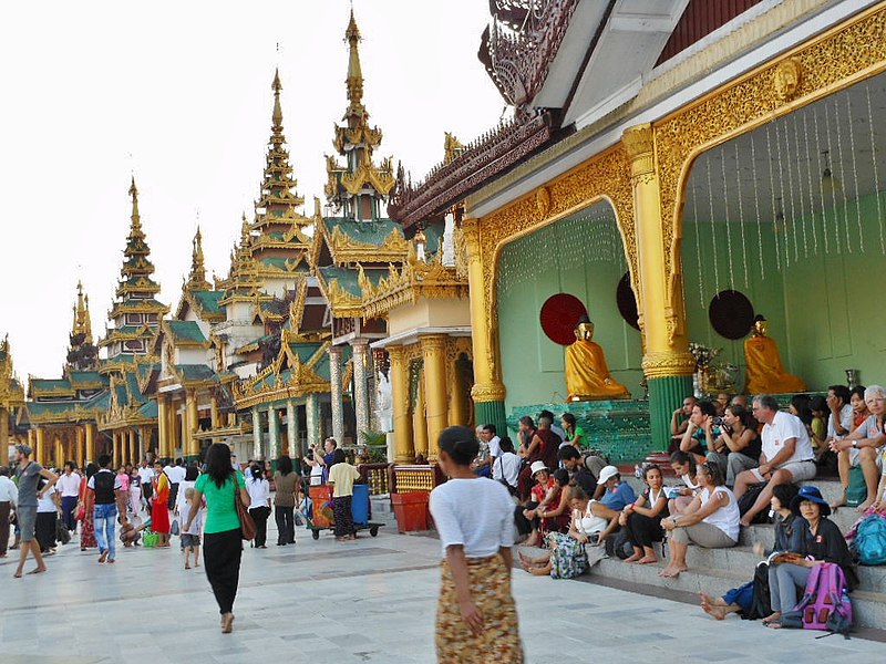
Tourism
Since 1992, the government has encouraged tourism in the country; however, fewer than 270,000 tourists entered the country in 2006 according to the Myanmar Tourism Promotion Board. Myanmar's Minister of Hotels and Tourism Saw Lwin has stated that the government receives a significant percentage of the income of private sector tourism services.
The most popular available tourist destinations in Myanmar include big cities such as Yangon and Mandalay; religious sites in Mon State, Pindaya, Bago and Hpa-An; nature trails in Inle Lake, Kengtung, Putao, Pyin Oo Lwin; ancient cities such as Bagan and Mrauk-U; as well as beaches in Nabule, Ngapali, Ngwe-Saung, Mergui. Nevertheless, much of the country is off-limits to tourists, and interactions between foreigners and the people of Myanmar, particularly in the border regions, are subject to police scrutiny. They are not to discuss politics with foreigners, under penalty of imprisonment and, in 2001, the Myanmar Tourism Promotion Board issued an order for local officials to protect tourists and limit "unnecessary contact" between foreigners and ordinary Burmese people.
Tourists in Myanmar
The most common way for travellers to enter the country seems to be by air. According to the website Lonely Planet, getting into Myanmar is problematic: "No bus or train service connects Myanmar with another country, nor can you travel by car or motorcycle across the border – you must walk across." They further state that "It is not possible for foreigners to go to/from Myanmar by sea or river. There are a small number of border crossings that allow the passage of private vehicles, such as the border between Ruili (China) to Mu-se, the border between Htee Kee (Myanmar) and Phu Nam Ron (Thailand)—the most direct border between Dawei and Kanchanaburi, and the border between Myawaddy (Myanmar) and Mae Sot (Thailand). At least one tourist company has successfully run commercial overland routes through these borders since 2013. "From Mae Sai (Thailand) you can cross to Tachileik, but can only go as far as Kengtung. Those in Thailand on a visa run can cross to Kawthaung but cannot venture farther into Myanmar.
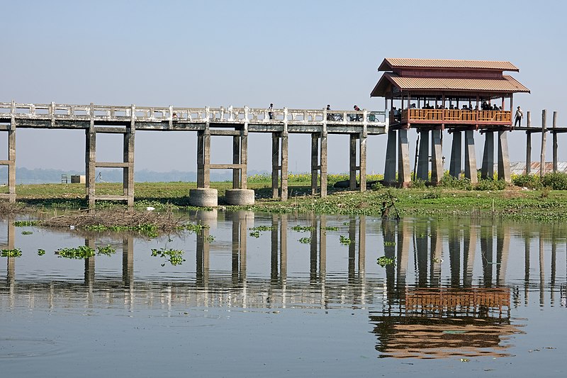
U Bein Bridge in Mandalay.
Flights are available from most countries, though direct flights are limited to mainly Thai and other ASEAN airlines. According to Eleven magazine, "In the past, there were only 15 international airlines and increasing numbers of airlines have begun launching direct flights from Japan, Qatar, Taiwan, South Korea, Germany and Singapore. Expansions were expected in September 2013, but yet again are mainly Thai and other Asian-based airlines according to Eleven Media Group's Eleven, "Thailand-based Nok Air and Business Airlines and Singapore-based Tiger Airline".
Ethnic groups
Myanmar is ethnically diverse. The government recognizes 135 distinct ethnic groups. There are at least 108 different ethnolinguistic groups in Myanmar, consisting mainly of distinct Tibeto-Burman peoples, but with sizable populations of Tai–Kadai, Hmong–Mien, and Austroasiatic (Mon–Khmer) peoples.
The Bamar form an estimated 68% of the population. 10% of the population are Shan. The Kayin make up 7% of the population. The Rakhine people constitute 4% of the population. Overseas Chinese form approximately 3% of the population. Myanmar's ethnic minority groups prefer the term "ethnic nationality" over "ethnic minority" as the term "minority" furthers their sense of insecurity in the face of what is often described as "Burmanisation"—the proliferation and domination of the dominant Bamar culture over minority cultures.
Languages
Myanmar is home to four major language families: Sino-Tibetan, Tai–Kadai, Austro-Asiatic, and Indo-European.[315] Sino-Tibetan languages are most widely spoken. They include Burmese, Karen, Kachin, Chin, and Chinese (mainly Hokkien). The primary Tai–Kadai language is Shan. Mon, Palaung, and Wa are the major Austroasiatic languages spoken in Myanmar. The two major Indo-European languages are Pali, the liturgical language of Theravada Buddhism, and English. More than a hundred languages are spoken in total. Since many of them are known only within small tribes around the country, they may have been lost (many if not all) after a few generations.
Burmese, the mother tongue of the Bamar and official language of Myanmar, is related to Tibetan and Chinese. It is written in a script consisting of circular and semi-circular letters, which were adapted from the Mon script, which in turn was developed from a southern Indian script in the 5th century. The earliest known inscriptions in the Burmese script date from the 11th century. It is also used to write Pali, the sacred language of Theravada Buddhism, as well as several ethnic minority languages, including Shan, several Karen dialects, and Kayah (Karenni), with the addition of specialised characters and diacritics for each language.
The Burmese language incorporates widespread usage of honorifics and is age-oriented. Burmese society has traditionally stressed the importance of education. In villages, secular schooling often takes place in monasteries. Secondary and tertiary education take place at government schools.
Religion
A large majority of the population practices Buddhism; estimates range from 80% to 89%. According to 2014 Myanmar Census, 87.9% of the population identifies as Buddhists. Theravāda Buddhism is the most widespread. There are some 500,000 Buddhist monks and 75,000 nuns in this country of 54 million. Other religions are practised largely without obstruction, with the notable exception of some religious minorities such as the Rohingya people, who have continued to have their citizenship status denied and treated as illegal immigrants instead, and Christians in Chin State.
According to 2014 census, 6.2% of the population identifies as Christian; 4.3% as Muslim; 0.8% as followers of tribal religions; 0.5% as Hindus; 0.2% as followers of other religions; and 0.1% follow no religion. According to the 2010 estimates of the Pew Research Center, 7% of the population is Christian; 4% is Muslim; 1% follows traditional animistic beliefs; and 2% follow other religions, including Mahayana Buddhism, Hinduism, and East Asian religions. Jehovah's Witnesses have been present since 1914 and have about 80 congregations around the country and a branch office in Yangon publishing in 16 languages. A tiny Jewish community in Yangon had a synagogue but no resident rabbi to conduct services.
Although Hinduism is practised by 0.5% of the population, it was a major religion in Myanmar's past. Several strains of Hinduism existed alongside both Theravada Buddhism and Mahayana Buddhism in the Mon and Pyu period in the first millennium, and down to the Pagan period (9th to 13th centuries) when "Saivite and Vaishana elements enjoyed greater elite influence than they would later do. Burmese folk religion is practiced by many Bamars alongside Buddhism.
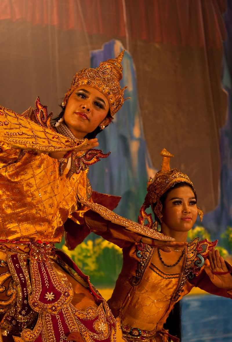
Culture
A diverse range of indigenous cultures exist in Myanmar, with majority culture primarily Buddhist and Bamar. Bamar culture has been influenced by the cultures of neighbouring countries, manifested in its language, cuisine, music, dance and theatre. The arts, particularly literature, have historically been influenced by the local form of Theravada Buddhism. Considered the national epic of Myanmar, the Yama Zatdaw, an adaptation of India's Ramayana, has been influenced greatly by Thai, Mon, and Indian versions of the play. Buddhism is practised along with nat worship, which involves elaborate rituals to propitiate one from a pantheon of 37 nats.
In a traditional village, the monastery is the centre of cultural life. Monks are venerated and supported by the lay people. A novitiation ceremony called shinbyu is the most important coming of age events for a boy, during which he enters the monastery for a short time. All male children in Buddhist families are encouraged to be a novice (beginner for Buddhism) before the age of twenty and to be a monk after the age of twenty. Girls have ear-piercing ceremonies at the same time. Burmese culture is most evident in villages where local festivals are held throughout the year, the most important being the pagoda festival. Many villages have a guardian nat, and superstition and taboos are commonplace.
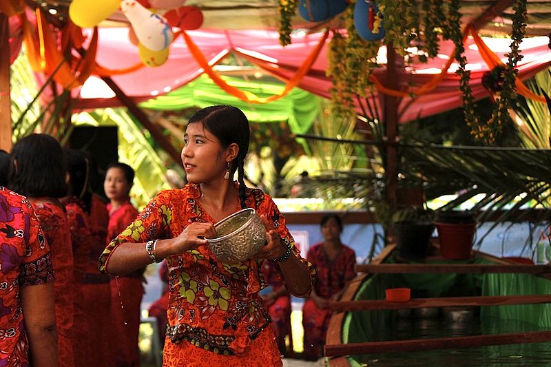
An Arakan (Rakhine) girl pours water at revellers during the Burmese New Year Thingyan Water Festival in Yangon.
British colonial rule introduced Western elements of culture to Myanmar. Myanmar's education system is modelled after that of the United Kingdom. Colonial architectural influences are most evident in major cities such as Yangon. Many ethnic minorities, particularly the Karen in the southeast and the Kachin and Chin who populate the north and northeast, practice Christianity. According to The World Factbook, the Burman population is 68% and the ethnic groups constitute 32%. However, the exiled leaders and organisations claims that ethnic population is 40%, which is implicitly contrasted with CIA report (official US report).
Cuisine
Burmese cuisine is characterised by extensive use of fish products such as fish sauce, ngapi (fermented seafood) and dried prawn.
Mohinga is the traditional breakfast dish and is Myanmar's national dish. Seafood is a common ingredient in coastal cities such as Sittwe, Kyaukpyu, Mawlamyaing (formerly Moulmein), Mergui (Myeik) and Dawei, while meat and poultry are more commonly used in landlocked cities like Mandalay. Freshwater fish and shrimp have been incorporated into inland cooking as a primary source of protein and are used in a variety of ways, fresh, salted whole or filleted, salted and dried, made into a salty paste, or fermented sour and pressed.
Burmese cuisine also includes a variety of salads (a thoke), centred on one major ingredient, ranging from starches like rice, wheat and rice noodles, glass noodles and vermicelli, to potato, ginger, tomato, kaffir lime, long bean, lahpet (pickled tea leaves), and ngapi (fish paste).
Media and communications
Due to Myanmar's political climate, there are not many media companies in relation to the country's population, although a certain number exists. Some are privately owned. All programming must meet with the approval of the censorship board.
The Burmese government announced on 20 August 2012 that it would stop censoring media before publication. Following the announcement, newspapers and other outlets no longer required approved by state censors; however, journalists in the country can still face consequences for what they write and say.
In April 2013, international media reports were published to relay the enactment of the media liberalisation reforms that we announced in August 2012. For the first time in numerous decades, the publication of privately owned newspapers commenced in the country.
Internet
Internet use is estimated to be relatively low compared to other countries. Myanmar's internet used to be subject to censorship, and authorities viewed e-mails and posts on Internet blogs until 2012 when the government removed media censorship. During the strict censorship days, activity at internet cafes was regulated, and one blogger named Zarganar was sentenced to prison for publishing a video of destruction caused by Cyclone Nargis in 2008; Zarganar was released in October 2011.
In regards to communications infrastructure, Myanmar is the last ranked Asian country in the World Economic Forum's Network Readiness Index (NRI) – an indicator for determining the development level of a country's information and communication technologies. With 139 countries reported on, Myanmar ranked number 133 overall in the 2016 NRI ranking.
Money
The official currency in Myanmar is the Burmese Kyat (MMT), pronounced like the English word 'chat'. The Kyat is broken into 100 pyas, and you'll find note denominations of K1,000, 500, 200, 100, 50, 20, 10, 5 and 1.
The Kyat is a closed currency, so we recommend either taking Thai Baht or USD in. They are super strict though, so make sure your notes are in perfect conditions. By perfect we mean iron flat, no tears, marks or scratches.
You will need the USD for your visa and national park fees, however, they are likely to accept THB for your purchases and give change in MMT. Myanmar itself is very cheap, so we recommend only taking smaller THB notes. This prevents you from getting ripped off if shop vendors don't have enough change or shorthand you in the conversion from THB to MMT.
Myanmar is a cash-based society, and there are limited to no ATMs, so be sure to get plenty of cash before you enter. You can buy USD and THB from Travel Money Oz before you depart Australia.
It's also important to highlight that if you are visiting more remote areas, money may have no use to you at all. Many of the outlying regions get no benefit from money unless they are travelling to the bigger cities (which they rarely do) so they may be more inclined to trade with you instead. By trade, we mean swapping a pen for a beer, or a pair of thongs for a meal. It sounds crazy to us, but it makes sense when you think about it. So, if you are planning to visit more remote towns on the mainland or in the archipelago, we recommend packing useful things you would be happy to trade. Think fans, pens, water bottles, solar torches, mosquito nets and bandaids - they are nothing to us but everything to them.
Warning: count(): Parameter must be an array or an object that implements Countable in /home/attravel/domains/attravel.vn/public_html/tmp/%%23^23C^23C8E1ED%%cat.tpl.php on line 92