Ca Mau Overview
Ca Mau province is located in the southern tip of Vietnam with 307 kilometers long coastline. The province shares the common border with Kien Giang, Bac Lieu provinces on the north and east; the other directions are surrounded by the East Sea. Its name came from the Khmers who inhabited the area before the arrival of the Vietnamese, “Ca Mau” means "black" in Khmer.
Topography
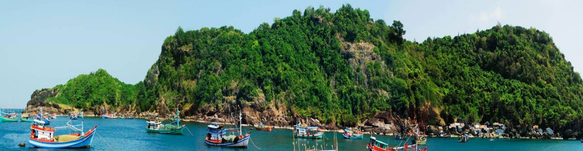
In general, Ca Mau has a relatively flat terrain with several fat plains accompanied by a complex system of rivers and channels. There are seven big rivers: Ong Doc River, Bay Hap River, Cai Lon River, GanhHao River, Dam Doi River, Trem Trem River, anh Bach Nguu River. Beside the area in mainland, Ca Mau also has two islands named Hon Khoai and Hoi Chuoi.
Climate
Located in the southernmost region of Vietnam and surrounded mostly by the East Sea, Ca Mau province is featured by sub-equatorial monsoon climate conditions. There are two main seasons in a year: rainy season from May to October, and dry season from November to April of the next year. The annual average temperature is 26.5oC. Ca Mau rarely suffers from storms and floods.
Tourism
With its dense rivers and canals system, Ca Mau is home to well-known forests: U Minh forest and Nam Can forest. Its interlacing rivers and canals have generated tangled flows in the province. Some offshore islands are: Hon Da Bac, Hon Khoai and Hon Chuoi. There are two types of forest in Ca Mau province: salt marsh and cajuput. The cajuput forest has the highest biological value among other types of natural forest, with high economic value and environmental protection. Ca Mau has great potential in developing ecological tourism thanks to the salt-marsh ecological system and diversified flora and fauna system. Ca Mau is well-known for U Minh cajuput forest and Nam Can mangrove forest. Besides, there is also a historical vestige, Khoai Island, which is closely related to the insurrection led by hero Phan Ngoc Hien. Rather than those, Ca Mau is also well known for its bird sanctuaries: Cai Nuoc, Dam Doi, Ngoc Hien, etc. Most of all, Ngoc Hien bird sanctuary attracts more and more visitors. Visiting Ca Mau, the southernmost of Vietnam, tourists will meet friendly southerners and join in the peaceful living atmosphere there.
Transportation
Ca Mau is 130km from Rach Gia, 180km from Can Tho, and 380km from Ho Chi Minh City. National Highways No.1A, 63 connect Ca Mau to Bac Lieu and Kien Giang provinces. Besides, there are boats running from Ca Mau to Ho Chi Minh City, Rach Gia. Tourist can visit U Minh and Ngoc Hien by ferry.


.png "Travel Tips")