Ninh Thuan Overview
The coastal province of Ninh Thuan lies in the south of Vietnam, about 1.382km from Hanoi and 350km from Ho Chi Minh City. Ninh Thuan shares its border with Khanh Hoa province on the north, Binh Thuan province on the south and the East Sea on the east. With the strategic location, the province is an important transportation node with the North-South Railway, the 1A and the 27 National Highway. It is also a well-know tourist destination with many beauty spots.
Topography
Ninh Thuan's topography is typical for the South Central Coast in that high mountains are located not only near western border to the Central Highlands, but also near the coast, the highest of which is Chua Mountain at 1040m in the north-east of the province. Several other peaks with heights up to 643m (Da Bac Mountain in the south) are located along the coast. The highest mountains are located at the borders to Khanh Hoa province and Lam Dong province, with three mountains of over 1600 and the highest at 1652m. Only a small part of the province around Phan Rang has elevations of under 50m. The province's major river is Dinh River, which flows through the main lowland of the province as well as Phan Rang. It has several tributaries in the province and is connected to Don Duong Lake in Lam Dong province.
Climate
Ninh Thuan lies within the driest region with tropical monsoon climate. The province has no winter and there are two seasons a year: rainy season from September to November and dry season from December to August. The annual average temperature is 27oC. Ninh Thuan’s weather is quite extreme with hot and dry atmosphere all year round. It is advisable that tourists make their trip during December to January when the weather is less extreme. In contrast, they should avoid traveling to this region in September to November since there may be hard rain and storms.
Tourism
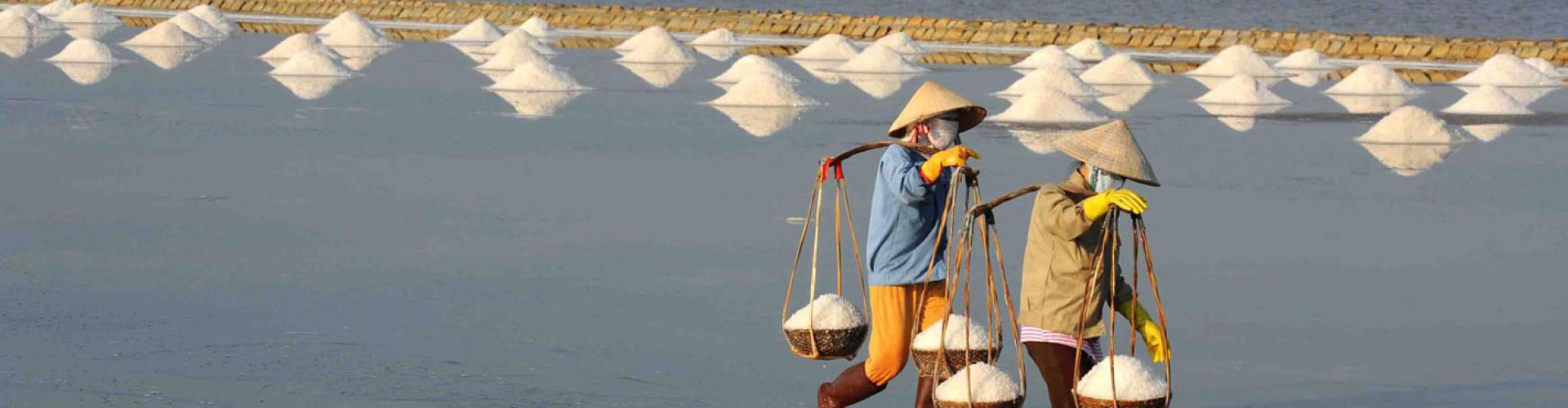
Ninh Thuan belongs to tourism triangles: Dalat- Nha Trang- Phan Rang. Coming to there, tourists are able to relax in Ca Na Tourist Site, swim in Ninh Chu Beach, Vinh Hy Bay, climb to Da Trang Mountain, and observe natural animals in Phan Rang Reservation, or visit Pi Nang Tac Stone Trap. Being home of Cham minority group, Ninh Thuan has characters culture of Cham ethnic, which stamp in local custom, Cham dance, sculpture, pottery, and brocade and agriculture of Cham towers. Famous towers name Po Klong Garai and Porome. Nowadays, Cham people still preserve matriarchy, a valuable inheritance of Vietnam, and special festivals such as Kate and Cha Bun ceremonies, Royal Idiladha and Ra Glai Tribe festivals and other ceremonies like dig a ditch, dam up, new rice. Kate Ceremony is the biggest and most joyful festival of Cham people, taking place in Ninh Thuan and Binh Thuan Provinces. The ceremony is held at Poklong Garai and other Cham Towers to commemorate national heroes, ancestors, and deities of the Cham, as well as King Poklong and King Porome.
Transportation
Phan Rang - Thap Cham City is 105km from Nha Trang, 110km from Dalat, 350km from Ho Chi Minh City and 1.382km from Hanoi. Phan Rang Town is on North- South Express Train, National Highway No.1A and National Highway No.27.


.png "Travel Tips")