Nghe An Overview
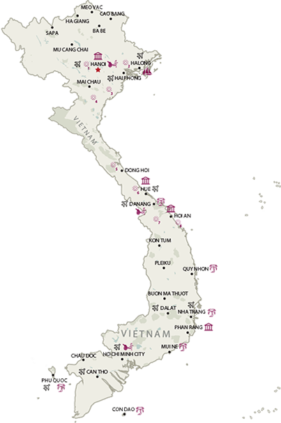
Nghe An is a large province in the central part of Vietnam that connects the North to the South. Nghe An shares its border with Thanh Hoa in the north, East Sea in the east, Laos in the west, and Ha Tinh in the south. Vinh, the capital city and also the largest city of Nghe An, is located 291km to the South of Hanoi. Interestingly, Nghe An Province and Ha Tinh Province used to be called Nghe Tinh Province from 1976 to 1991. Not until then were the two of them separated and renamed as nowadays.
Topography
As Nghe An is parts of the giant Truong Son Mountain Range, 83% of its area is mountainous, making its topography highly complicated. The terrain has a descending slope from North-West to South-East; is separated by mountains, hills, rivers, streams, etc. into many small valleys. In terms of height, the 2,711m high Pulaileng Peak in Ky Son District is most noticeable, while the 0.2m high plains in Yen Thanh Districts are the most humble. Besides, Nghe An also has a highly dense system of rivers with a total length of 9828km. The biggest river is Ca River (also known as Lam River) which actually originates from Laos. The coastline of the province is 82km with 6 watercourse-mouths which allow seaports and sea transportation to develop conveniently.
Climate
With a monsoonal tropical climate, Nghe An enjoys its 4 distinct seasons. While from April to August, it is affected by the dry Southwestern winds, the province experiences the humid and cold Northeastern winds during winter. However, the weather is still favorable most of the time. The annual average temperature is 25.2oC.
Tourism
Nghe An has enjoyed favorable conditions in terms of geographical location. The province has the national highways and railway, as well as the Cua Lo International Port and Vinh Airport. Nghe An marks the starting point of the Heritage route in the central part, and the legendary Ho Chi Minh Trail. In addition, it is also the starting point of the tourist route following the east-west corridor, connecting Vinh- Laos- Thailand through Highway No. 8. Two thirds of its area is forested. Nature has endowed Nghe An with beautiful landscapes for tourism development. Among them include its long seaside with pristine beaches, especially Cua Lo which is considered one of the best in Vietnam, and Pu Mat National Park, which is home to diverse flora and fauna, apart from breath-taking landscapes. Nghe An takes pride in its tradition in the building and defence of the nation. One hundred and thirty-one historical-cultural sites have been recognized as national treasures. The Kim Lien historical-cultural site, the native village of President Ho Chi Minh, World Cultural Celebrity and National Liberation Hero, is one among those. As a result of its diverse population, Nghe An is a kingdom of many traditional festivals organized on the rivers such as Cau Ngu Festival, Ruoc Hen Festival. Besides, there are also many festivals illustrating the local myths, tales, and important historical events such as the Cuong Temple Festival, the Van Loc Village Festival, the Lotus Village Festival, etc. Nghe An people have won kudos for their intelligence, diligence, eagerness to study and their hospitality, cultural traditional imbued with national identity. Nghe An is fast changing with every passing days. It will be a highlighted destination for tourists near and far.
Transportation
Nghe An is one of the important clue of transportation throughout the country. It has diversified and developed transportation, including land road, railway, river road, air port and sea port which are formed and scattered quite reasonably by residential zone, economic and administration centre. Vinh City is 14km from Kim Lien Village, 16km from Cua Lo Beach, 291km from Hanoi, 368km from Hue, and 468km from Danang.


.png)